
当たり前のことですが、退職届を出してその日にすぐ辞めることはできません。
正しい退職のマナーを実践し、会社に残る人達に迷惑をかけないよう清々しく会社を去りましょう。
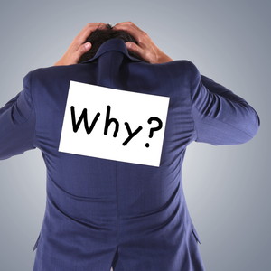
退職の意思を伝える
まずは直属の上司に落ち着いて相談できる時間を取ってもらい、退職の意思を伝えましょう。
あくまで『意思』であり、いきなり退職届を出したり、他の人がいる前で話を切り出すのはNG。
実際に退職するまでの期間もあるので、横暴な振る舞いはあなた自身の首を絞めることに繋がります。
その際、退職の理由を聞かれると思いますが、「一身上の都合」と答えるのが無難でしょう。
何かと理由をつけて同僚の個人的な悪口や会社の待遇面に対する不満を言いがちですが、
「状況を改善する」と言われたら、辞める理由がなくなってしまいます。
あえて伝えるとすれば、「自身のステップアップの為に」等、前向きな理由が良いでしょう。
会社に迷惑をかけないような引継ぎを
あなたが会社を辞めるということは、あなたが今までやってきたことを誰かが引き継がなければならないということ。
法律では、退職届を提出してから2週間で退職することが可能ですが、後任者を探して引継ぎを完璧に済ませるには、およそ3ヵ月は必要です。
十分な引継ぎ期間を設ける為にも、時間の余裕を持って上司に辞める意思を伝えましょう。
未消化の有給休暇が残っている場合も、後任者へきちんと引継ぎができるかどうかを考えて有給休暇を取る必要があります。
間違っても自分勝手に残りの有給休暇をまとめて取るようなことをしてはいけません。
身の回りの整理整頓
どれだけきちんと引継ぎを済ませても、自分が使っていたデスクやロッカーが汚いと他の人達に迷惑をかけてしまいます。
会社から貸し出されている備品は、次に使う人のことを考えてキレイな状態で返却しましょう。
名刺も同じで、自分の名刺は勿論のこと、仕事で貰った他の人の名刺も置いていくのがマナーです。
また他の人が見て、何か分からないものを残してもいけません。
デスク周りのファイルやPCに保管した業務データは誰が見ても分かるようにしておきましょう。
あなたが会社を去った後、「このデータのパスワードが分からない」等で連絡が来る可能性があります。
退職時の挨拶
万人受けするお菓子を置いていくのが一般的。数が足りなくならないよう多めに買っておくのが礼儀です。
賞味期限が長く、取り分けやすい個別包装が喜ばれます。
そして最後のスピーチは簡潔にまとめましょう。あなたの退職日も他の人にとっては普段通りの一日です。
定年退職を迎える場合等は別ですが、大して勤続年数が長くない人が、自分の入社から退職までを振り返るのは失礼です。
職場の人達への感謝と会社の発展を願う一言があれば十分でしょう。
終わりに
『立つ鳥跡を濁さず』という言葉のように、その場所を離れる際は、皆に気持ち良く送り出してもらえるよう心懸けましょう。
『終わり良ければすべて良し』です。有終の美を飾れるよう少しでも参考にしていただければ幸いです。
